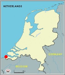
Homepage> Unique spot Global > Border Collections
国境コレクション Border Collections
今までに越えた国境を集めてみました。
Gallery of Borders where I crossed.
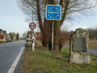
・オランダの国境めぐり Tracing the Dutch border line
- 国境線西端部 / West-end of the border line
- 最西端 / Westernmost point
- ベルギー最北端 / Belgian Northernmost point
- 国境を越える鉄道 / Railway crossing border
- 最南端 / Southernmost point
- 三国国境地点 / Tripoint
- 道路に引かれた国境線 / Border line drawn on a street
- ドイツ最西端 / German Westernmost point
- ドイツ国境の油田 / Oilfield at German border
- 最東端 / Easternmost point
- 国境線北端部 / Northern-end of the border line
- 最北端 / Northernmost point
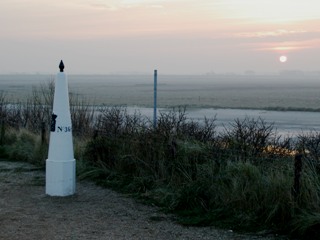
国境線西端部 / West-end of the border line
オランダ国境の西端部は北海に面する湿地帯です。
The west end of Dutch border is wetland area facing to North Sea.
google map
夕暮れの湿地帯に建つ白い国境標。2006年1月8日撮影
White border pole (Grenspel) standing at the sunset wetland. Photo on 8 Jan, 2006
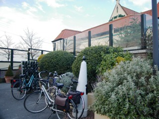
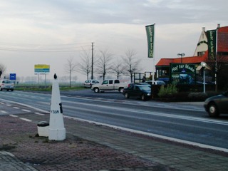
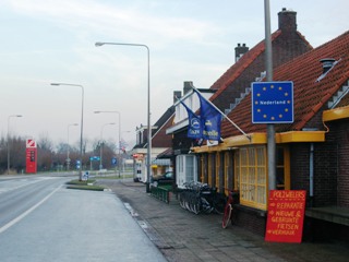
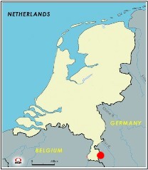
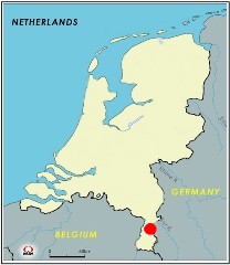
最西端 / Westernmost point

google map
(上左)ベルギーのレストラン横にあるオランダ最西端地点。駐車場はオランダ領内。
(上右)道路の反対側にも国境標が。2006年1月8日撮影
(下左)オランダのシント・アナ・テル・マウデンという街の入り口にあるオランダの標識。
(Upper left)The westernmost point of the Netherlands is located beside of Belgian Restaurant.
The parking area seems to be in Dutch territory.
(Upper right)There is another border pole at the opposite side of the road. Photo on 8 Jan, 2006
(Lower left) Dutch signpost at the entrance of a Dutch town, Sint Anna ter Muiden.
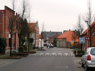
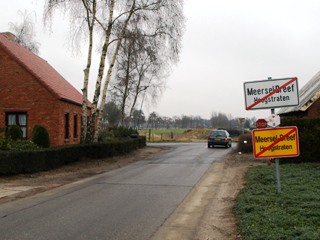
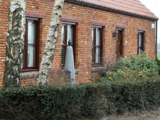
ベルギー最北端 / Belgian Northernmost point
 google map
(上左)ベルギー最北端の町、ドレーフ。
(上右)集落の最北端。
(下左)民家の横にある国境標。2006年2月4日撮影
(Upper left)Dreef, the Belgian Northernmost town.
(Upper right)The Northernmost area of the town.
(Lower left) Border pole is located beside of a house. Photo on 8 Jan, 2006
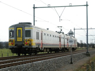
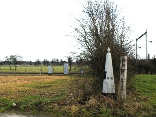
国境を越える鉄道 / Railway crossing border

 google map
(上)国境を越える電車。白い標識がオランダ国鉄の終点・ベルギー国鉄の起点を示す。
(下)線路際にある国境標。2006年2月19日撮影。
(upper)EMU crossing border. The white post shows the terminal of Dutch Railway and the origin of the Belgian Railway.
(lowert)The border post nearby the railway track. Photo on 19 Feb, 20066
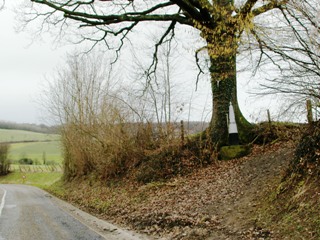
最南端 / Southernmost point
 google map
木の根元に建つオランダ最南端の国境標。2006年2月19日撮影。
The Southernmost Dutch border pole standing on the root of a tree. Photo on 19 Feb, 2006
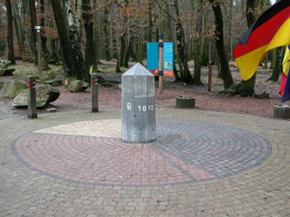
三国国境地点 / Tripoint

google map
オランダ・ベルギー・ドイツの三国国境地点。オランダの最高地点(標高322.5m)でもある観光名所。2006年2月19日撮影。
The tripoint of Dutch, Belgian and German border. It's also the Dutch highest point (322.5m), which attracts tourists. Photo on 19 Feb, 2006
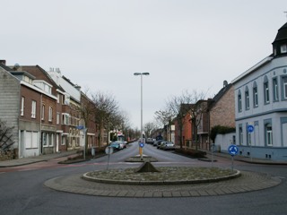
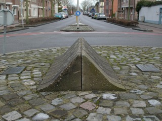
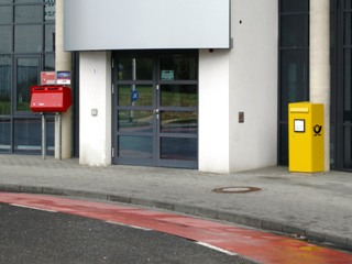
道路に引かれた国境線 / Border line drawn on a street
google map
(上左)ケルクラーデ市のNiewstraat/Neustrasse。左がオランダ、右がドイツ領。
(上右)かつては道路の中心には車両が国境を通過できないように縁石が敷かれていた。
(下左)建物の入り口が国境。左にオランダの郵便ポスト、右にドイツの郵便ポスト。2006年2月19日撮影
(Upper left)Niewstraat/Neustrasse in Kerkrade. Left is Dutch and Right is German territory.
(Upper right)Previously, vehicle traffic was blocked to cross the border line.
(Lower left)The entrance of the building is border. The left mail post is Dutch, and the right one is German. Photo on 19 Feb, 2006
ドイツ最西端 / German Westernmost point
google map
ドイツ最西端の地点に建つ石碑。2006年2月19日撮影
The stone monument tells the westernmost point of German territory. Photo on 19 Feb, 2006
ドイツ国境の油田 / Oilfield at German border
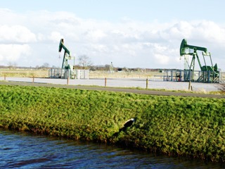
google map
オランダ国境沿いに広がるドイツの油田地帯。手前の水路が国境。2006年4月9日撮影
German oilfield along with Dutch border. The creek in front is the border. Photo on 9 Apr, 2006
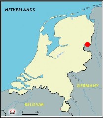
最東端 / Easternmost point
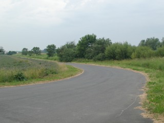

google map
A7高速道路がドイツに抜けるところがオランダ最東端。付近は畑作地。2006年6月25日撮影
A7 Motorway crosses the Dutch Easternmost point, farm area in the vicinity. Photo on 25 Jun, 2006
国境線北端部 / Northern-end of the border line
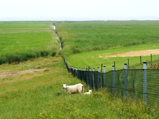

google map
牧草地になっているオランダ北端部。2006年6月25日撮影
The north-end of the Netherlands is meadowland. Photo on 25 Jun, 2006
最北端 / Northernmost point
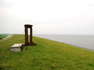

google map
モニュメントが建つオランダ本土最北端。2006年6月25日撮影
Monument for the northernmost point of Dutch mainland. Photo on 25 Jun, 2006
このページの内容を転載・複製する場合はご一報ください。 Please inform before you copy contents of this site.
Copyright(C) 2011 Takashi Kase, All Rights Reserved.